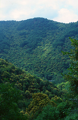
Today you will ride 36 kilometers along and nearby the historical pilgrimage route, mainly through woods, paralleling the GR6 variant of the walking route, and then the GR65. You will undertake climbs totaling about 700 meters or 2,300 feet, as did the ancient pilgrims. It is said that they were afraid of bandits lurking in the river gorges. Also, in those days, the rivers were higher and less tamed. Your destination, Conques***, is a highlight of this journey.
If climbs seem too daunting, you can circumnavigate the hills by staying along the river for 45 kilometers, a boring ride on low-traffic roads mainly in a narrow, viewless wooded gorge, as detailed after the main itinerary. In fact you can do that tomorrow as well, but you’ll miss out on some lovely scenery, on strengthening those muscles for the ride ahead, and on experiencing what the ancient pilgrims experienced, and all today’s walking pilgrims as well.
From Estaing, cross the bridge over the Lot river, and continue straight on D22, beginning a relentless, steep climb of about 180 meters, 600 feet over about 6 km. The road levels out, and you have a beautiful ridge-top ride until D22 comes to a T, 8 kilometers from Estaing. Turn right and follow D20 uphill, keeping right where D22 banches off left, an, and turning left at the sign towards Campuac, reached in another 3.5 kilometers. Don’t turn left at the statue where the GR 6 crosses; that road is rougher and hillier. The IGN maps and Geoportail.gouv.fr are completely incorrect for this area. Google maps are accurate.
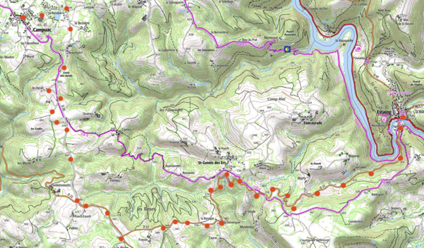
The route you have followed to Campuac is actually the ancient pilgrim route, whereas the GR 65 is not. (A road bike could not navigate this part of the GR65.) Should you wish to continue on the ancient route (which is not the same as that of GR65), do not turn left here off D20 towards Campuac but rather continue straight another 5 km to near Golinhac, where D20 turns left and at the crossroads continue on D42 to Espeyrac in another 8 or 9 km. This alternative routing is 5 km longer, and somewhat hillier than the route I recommend here.
You can now choose to immediately turn right onto highway D656, or to ride into the ineresting village of Campuac (B&B, gites, food). If you do ride into the village, turn right after the long stone wall and ride NW to D656. Follow D656 until its end. The road is beautiful — a flat or slightly descending ride through woods. Do not turn into La Roque. Do turn sharply left and then right to visit the village of Campagnac. Then, downhill, stay straight (left) at the Y and follow the road around sharply to the left at the bottom of the switchback. The road deadends at D42. Turn left. The village of Espéyrac is 0nly 300 meters to the right (hotel, gites, food).
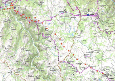
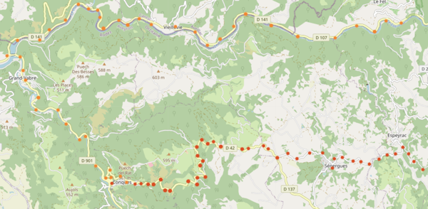
D42 climbs 265 meters (870 feet), passing through the town of Senergue (km 27.4,hotel, gites, shops), to a pass. Now, after several smaller descents and climbs through a countryside of open forest, you begin a long descent to Conques. If you need to find lodgings, or if you are not staying for the night, lock your bike at the lower end of the parking area. Once you have your accommodations (or if you are leaving town), walk your bike downhill into the village.
An alternative route of approximately 47 kilometers to Conques follows river valleys from Estaing—deviating completely from the ancient pilgrim’s route and avoiding that route’s 600 meters (2000 feet) of climbing. It is faster and easier, but out of the spirit of this journey, and much less interesting. To follow the alternative route, from Estaing, stay on the main road along the Lot river, D920, for 17 kilometers to Entraygues-sur-Truyère (hotels)*. Here you must ride through the town to reach the bridge over the Lot. Now follow the Lot gorge westward on D107 and then D141 to the intersection of D901, about 22 kilometers. Turn left and ride 5 kilometers south along the Dourdou River. to the roadsign for Conques***, which is a short, 60 meter (200 foot) climb up into the hills.